Back
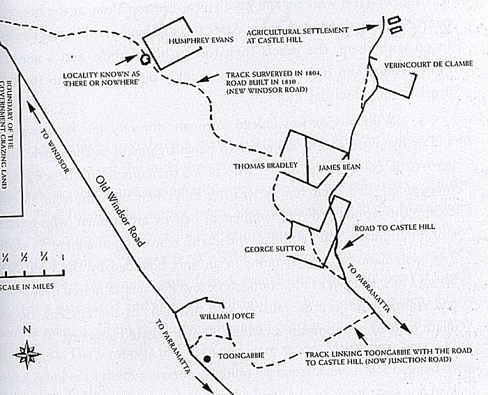
Map showing some of the settlement at Castle Hill in 1804. The approximate area of the apparitions is shown as a pale red square at the top-right. While there is nothing shown on the colonial map the site is positioned on one of the tracks used in colonial days to access Vericourt de Clambe's farm and would have used by both the rebels and the defenders before and after the conflict.
Sourced from The Battle of Vinegar Hill Australia's Irish Rebellion. by Lynette Ramsey Silver. The Watermark Press Sydney, Australia. 2002.
Page by Weblight Studio (Australia)
On the colonial trail at the end of Excelsior Ave
Over the years I have come to the conclusion that I witnessed the repeat of an atrocity carried out during the Irish Rebellion in 1804

Map 2